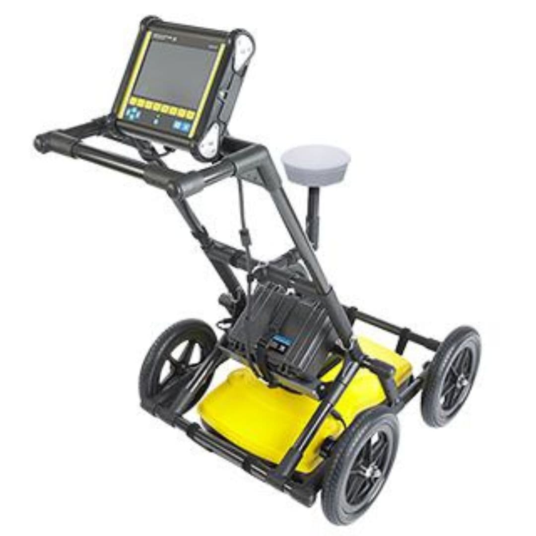
Industrial inspection equipment
Overview
Advanced GPR system for underground utility detection and mapping. Subsurface risk assessment supports safer excavation conflict prevention and informed construction planning by identifying hidden infrastructure before drilling trenching and ground disturbance begin.
Ground Penetrating Radar (GPR) is configured with Subsurface Utility Detection Across Complex Ground Conditions, Frequency Selection for Depth and Resolution Requirements, and Georeferenced Survey Data for Infrastructure Documentation to support reliable day-to-day inspection work in demanding operating conditions.
Key technical details include Frequency Range: 25 MHz - 1000 MHz, Penetration Depth: Up to 30 meters, Display: 10.1" High-resolution touchscreen, and Data Storage: 256 GB internal + SD card, helping teams evaluate fitment, access requirements, and inspection coverage before deployment.
This product is suited to applications such as Underground utility mapping, Concrete structure inspection, and Archaeological surveys, where repeatable imaging, measurement, or defect detection performance is important.
Get pricing, availability, and technical guidance.
Request QuoteResponse within 1 business day.
| Frequency Range | 25 MHz - 1000 MHz |
| Penetration Depth | Up to 30 meters |
| Display | 10.1" High-resolution touchscreen |
| Data Storage | 256 GB internal + SD card |
| Battery Life | 8-10 hours continuous operation |
| Operating Temperature | -20 degC to +50 degC |
| Weight | 8.5 kg (complete system) |
| Connectivity | Wi-Fi, Bluetooth, USB |
Underground utility mapping
Concrete structure inspection
Archaeological surveys
Environmental site assessment
Road and pavement evaluation
Geological investigations
Fill out the form below and our team will get back to you with detailed information about the Ground Penetrating Radar (GPR).
Interested in Ground Penetrating Radar (GPR)? Fill out the form below and our team will get back to you within 24 hours.
Ground Penetrating Radar uses high-frequency electromagnetic waves to generate real-time images of subsurface conditions, enabling engineers to detect both metallic and non-metallic utilities without excavation. Unlike conventional locating methods, it can identify PVC pipes, fibre optic ducts, concrete structures, voids, and buried utilities, making it valuable for infrastructure development, smart city projects, highways, airports, and metro rail construction across India.
Ground Penetrating Radar is extensively used for metro rail corridors, highways, airports, industrial facilities, smart cities, oil and gas installations, telecom infrastructure, power transmission projects, municipal utility mapping, bridge construction, railway modernisation, and urban redevelopment initiatives where accurate underground intelligence is required before excavation activities begin.
Multi-frequency and configurable systems can support different applications when paired with suitable antennas and survey settings. The required configuration depends on whether the project involves shallow utilities, concrete structures, pavement layers, or deeper geological features.
Yes. One of the primary advantages is its ability to detect both conductive and non-conductive underground assets. In addition to metallic pipes and cables, it can identify plastic water pipelines, fibre optic ducts, concrete drainage systems, underground storage structures, and voids that may not be detectable using electromagnetic locating equipment alone.
Yes. It can detect subsurface anomalies associated with non-metallic materials such as PVC pipes, plastic ducts, and concrete structures when sufficient contrast exists between the target and surrounding ground. Detection reliability depends on target size, depth, material properties, and soil conditions.
The two technologies serve different purposes and are often used together. Electromagnetic locating is effective for conductive utilities or traceable lines, while radar-based investigation can identify non-conductive pipes, ducts, voids, and other subsurface features.
Performance depends on soil composition, moisture levels, ground conditions, target size, burial depth, and the contrast between the target and surrounding material. A site assessment before deployment helps determine the most suitable antenna frequency and survey configuration.
Detection depth varies according to antenna frequency, soil conductivity, moisture content, target dimensions, and site conditions. Lower frequencies generally investigate deeper areas, while higher frequencies provide greater detail at shallower depths.
High soil conductivity, excessive moisture, dense reinforcement, multiple overlapping utilities, metallic surface objects, and deep or small targets can affect signal interpretation. Experienced operators should evaluate survey results alongside site records and complementary detection methods.
The appropriate frequency depends on the required investigation depth and level of detail. Higher frequencies are generally preferred for shallow high-resolution surveys, while lower frequencies are selected when deeper subsurface investigation is required.
By providing subsurface imaging before excavation begins, GPR enables contractors to identify buried utilities, underground obstructions, and structural anomalies that may otherwise remain undetected. This proactive approach can minimise accidental utility strikes, reduce project delays, improve workforce safety, lower restoration costs, and support better construction planning.
Ground Penetrating Radar provides underground mapping capabilities that can improve project planning, enhance utility documentation, reduce excavation uncertainty, strengthen risk management, and optimise construction efficiency. For engineering consultants, EPC contractors, and infrastructure developers, the technology can help minimise project risks while protecting critical underground assets.
Provide the project location, survey area size, ground surface type, expected target depth, type of suspected utilities or structures, and required deliverables. This information helps determine the appropriate system configuration and technical requirements.
Yes. Professional operation involves data collection, antenna selection, survey planning, and interpretation of subsurface responses. Training helps operators understand system limitations and distinguish potential targets from geological features, clutter, and unrelated reflections.
Purchasing equipment may be suitable for organisations with frequent inspection requirements and trained technical teams. Hiring a specialist may be more practical for one-time projects, highly complex sites, or applications requiring experienced interpretation and professional deliverables.